


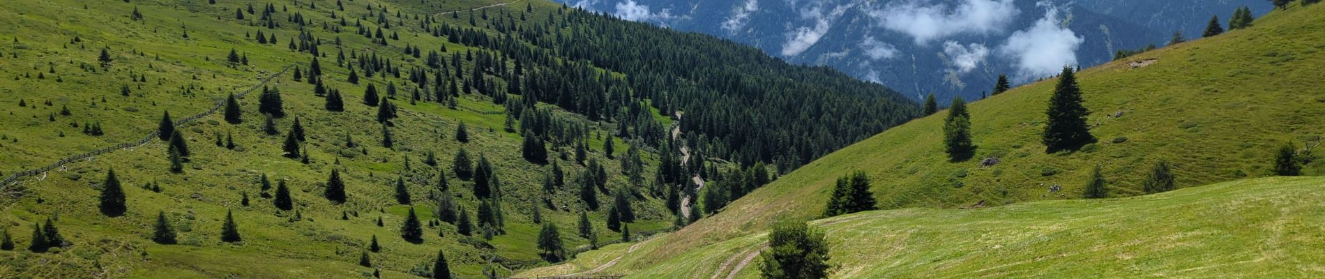
Lüsner Alm - Sommet du Campill

VacheKiri67
User
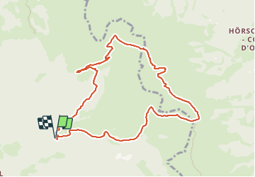


5h13
Difficulty : Medium

FREE GPS app for hiking
 SityTrail
IGN / Geographical institutes
SityTrail Plus
The world is yours!
About
Trail Walking of 10.5 km to be discovered at Trentino-Alto Adige/Südtirol, South Tyrol, Lüsen - Luson. This trail is proposed by VacheKiri67.
Description
Faite le 19/07/2023. D'après "Wandern in Südtirol : Eisacktal, das Tal der Wege - 6 Zum Campill-Gipfel auf der Lüsner Alm". Durée indiquée pour le circuit : 4h00. Parking payant au Schwaiger Böden P3. Nous nous sommes abrités à 6 dans la toute petite chapelle au Jakob-stöckl pendant un orage subit.
Photos


35 photos in total. Please click on a photo to see them all in the gallery.
Positioning
Comments